Marine AIS Tracking & Transmission
Real-Time AIS Tracking to Protect Marine Zones, Optimize Port Operations, and Enhance Safety
Comprehensive Maritime Solutions
Powerful tools for vessel management, industry networking, and environmental protection.
Tracking & Operations
Gain real-time visibility into vessel movements, optimize port operations, and enhance maritime safety with MotionInfo’s advanced AIS tracking solutions. Our technology provides continuous monitoring, route optimization, and regulatory compliance tools, ensuring seamless operations for ports, fleets, and offshore industries.
Asset Protection
Safeguard critical marine infrastructure with automated vessel alerts, virtual AIS markers, and compliance enforcement. MotionInfo’s AWARE Network helps protect subsea cables, offshore platforms, conservation areas, and restricted zones, ensuring that unauthorized or hazardous activity is detected before damage occurs.
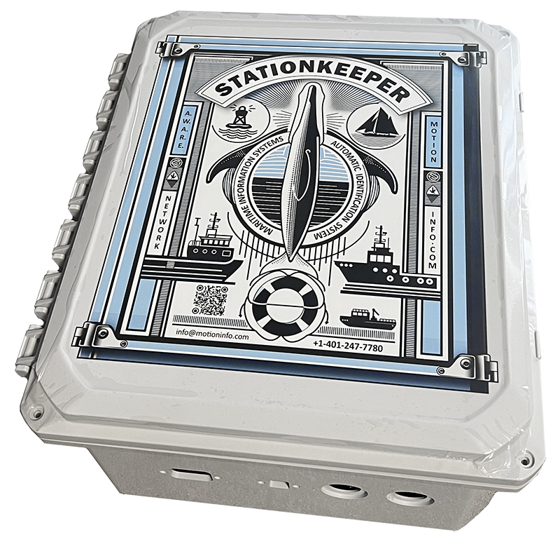
StationKeeper
Prevent vessel collisions and protect marine wildlife and conservation areas with real-time AIS monitoring and automated speed alerts. StationKeeper helps enforce NOAA speed restrictions, protect endangered species like the North Atlantic Right Whale, and improve environmental compliance for marine industries.
Real-Time Marine Intelligence for Smarter Operations
AIS live and historic tracking for your marine operation.
MotionInfo’s AIS tracking and operations solutions provide real-time visibility into vessel movements, ensuring safer, more efficient, and compliant maritime operations. Whether optimizing port traffic, fleet management, or offshore activities, our technology delivers the data and insights you need to operate with confidence.
- Real-Time Vessel Tracking – Continuous AIS monitoring for precise location data and movement history.
- Port & Traffic Optimization – Reduce congestion, improve scheduling, and streamline maritime logistics.
- Operational Efficiency – Enhance fleet coordination, reduce delays, and improve fuel efficiency.
- Compliance & Safety – Ensure adherence to local and international maritime regulations.
- Advanced Reporting & Analytics – Gain actionable insights with historical and live tracking data.
Proactive Protection for Critical Marine Assets
MotionInfo’s AWARE Network safeguards both commercial infrastructure and environmentally sensitive areas by actively monitoring vessel movements and sending real-time compliance alerts. Whether securing vital undersea cables or protecting endangered marine species, our solutions ensure regulatory adherence and risk mitigation.
Commercial Asset Protection
Prevent Damage to Cables, Pipelines, and Marine Infrastructure
MotionInfo provides real-time tracking and proactive notifications to vessels operating near sensitive commercial assets, reducing the risk of accidental damage and unauthorized activity.
- Undersea Cable & Pipeline Protection – Automated alerts warn vessels before they enter restricted areas.
- Port & Offshore Infrastructure Security – Geofencing and monitoring prevent unauthorized access to critical assets.
- Incident Reporting & Compliance – Track vessel interactions to support regulatory investigations and liability assessments.
Environmental & Habitat Protection
Protect Marine Ecosystems and Endangered Species
Our system enforces conservation area restrictions and proactively notifies vessels about marine protected zones, reducing environmental impact and ensuring compliance with conservation efforts.
- Habitat & Marine Protected Area (MPA) Security – Automated alerts keep vessels clear of sensitive ecological zones.
- Endangered Species Protection – Real-time enforcement of NOAA speed regulations helps prevent vessel strikes.
- Conservation Compliance & Data Insights – Historical tracking ensures adherence to environmental regulations.
Marine Zones: Safeguarding Protected Waters
Enhancing Environmental Protection with Real-Time AIS Technology
MotionInfo’s AIS solutions play a critical role in managing and safeguarding protected marine zones, from fisheries to endangered habitats. By leveraging real-time tracking and automated alerts, we help vessels stay compliant with environmental regulations while minimizing risks to sensitive marine areas.
Protecting Vulnerable Species and Habitats
Our StationKeeper program uses AIS technology to promote safe and responsible navigation within critical habitats, such as those of the endangered North Atlantic Right Whale. Through automated alerts and real-time monitoring, vessels can safely navigate around these areas, reducing the risk of harmful interactions.
- Sends automated slow-down alerts to vessels near protected areas.
- Monitors vessel speeds to ensure compliance with NOAA speed rules.
- Protects species like the North Atlantic Right Whale from vessel strikes.

Supporting Compliance and Sustainable Practices
For fisheries, conservation areas, and environmentally regulated zones, AIS helps monitor and enforce sustainable practices. Real-time data allows for proactive protection of these valuable areas, ensuring that vessels operate responsibly and in compliance with established guidelines.
- Tracks vessel movement to enforce no-fishing zones.
- Provides virtual markers to indicate environmental boundaries.
- Shares data with conservationists and maritime authorities for enhanced collaboration.
Optimize Your Maritime Operations with Real-Time AIS Insights
Track, manage, and protect your assets at sea with MotionInfo’s advanced marine solutions.
Custom Development & Integrations
Flexible AIS Solutions to Fit Your Unique Maritime Requirements
MotionInfo’s custom development services provide tailored AIS tracking, reporting, and management solutions that seamlessly integrate with your existing systems. From specialized vessel tracking features to data analysis tools, we design and implement solutions that address your specific operational needs.
- Customized AIS Features: Add or modify AIS tracking capabilities to support unique workflows, compliance requirements, or safety measures.
- System Integrations: Connect MotionInfo’s AIS technology with your current infrastructure, ensuring a unified data flow across platforms.
- Scalable Solutions: Our custom development scales with your operations, whether you’re expanding fleet management or incorporating environmental monitoring.
- Historical Data Analysis: Access comprehensive historical AIS data to support accident reconstruction, asset protection, and operational reviews.
With MotionInfo’s custom development, you get a powerful, adaptable AIS solution that enhances efficiency, safety, and visibility in your maritime operations.
%20development%20and%20integration%20services%20for%20.webp)
